Real-Time River Information / Notification System
June 21, 2021
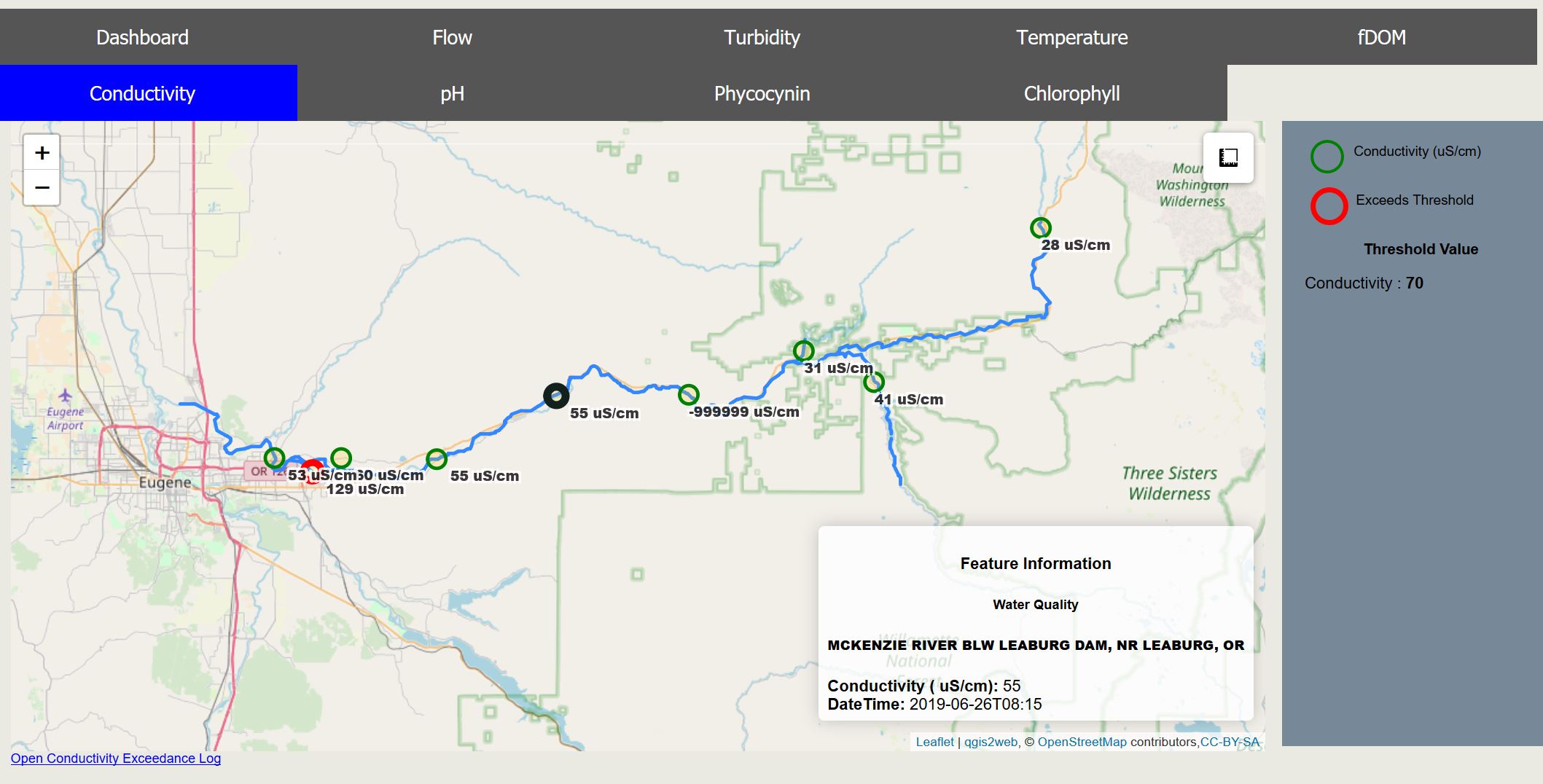
Eugene Water and Electric Board (EWEB) contracted with Enviro Spatial to develop and host a real-time river information system (RIS) that presents flow and water quality data for the McKenzie watershed. The RIS exploits river gauge station data provided by NWIS and also integrates data provided directly by EWEB using their Hydrosphere software. The system presents the real-time data in a easy to visualize Dashboard as well as maps that show water quality / flow values. Parameter values that exceed user defined thresholds are flagged by the RIS. In addition, the RIS provides real-time notification of exceedances to a user list of contacts via email and SMS.
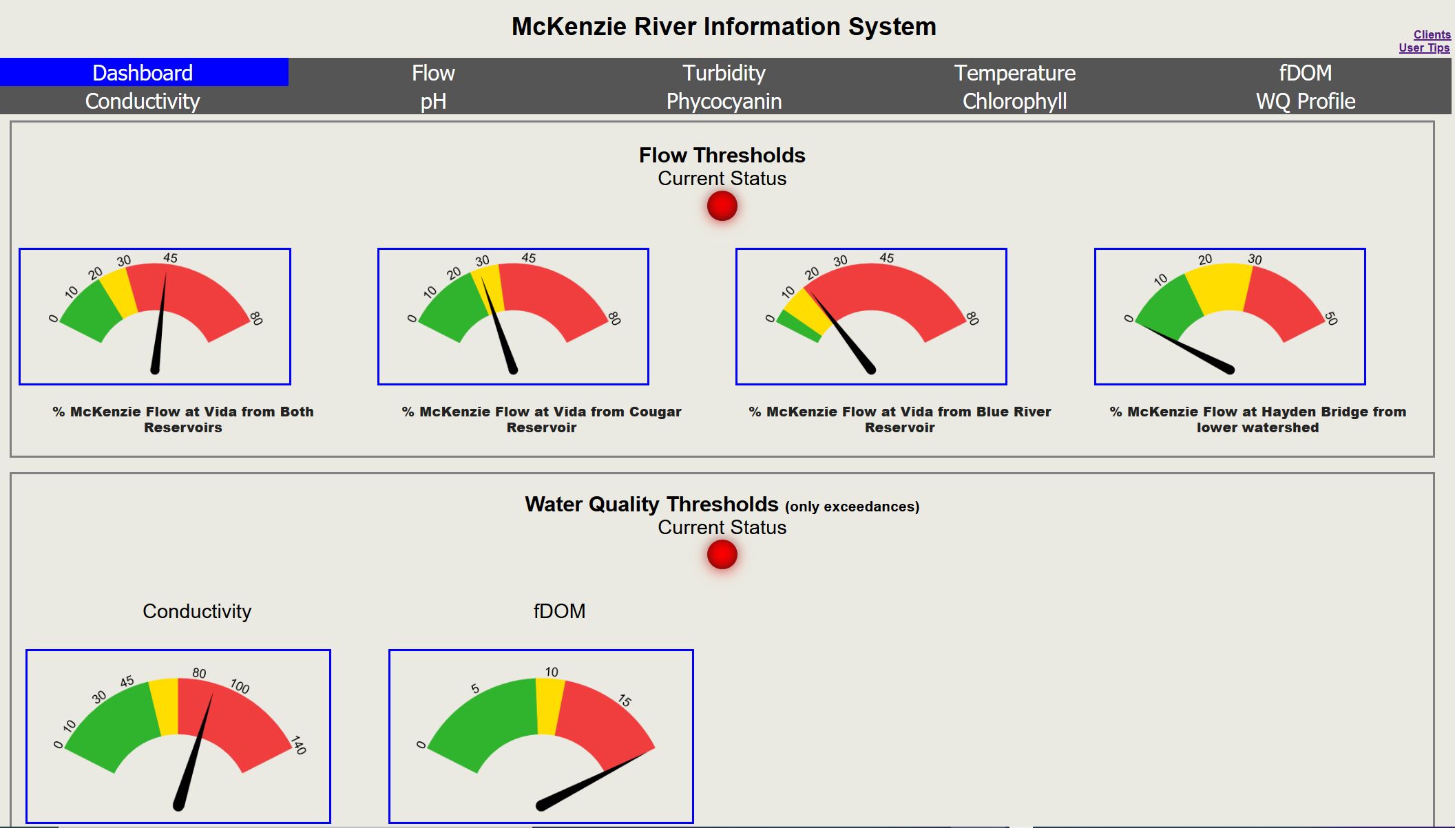
RIS – Dashboard
RIS – Flow